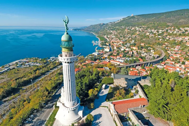
Italy is emblematic of the Mediterranean. Its long arm juts out into the sea towards the African continent. The Romans brought together the whole region and put their capital at the centre of the world. They exported their way of life wherever they went. It shaped not just the history of the region, but also the different ways of living in Italy today. This is true as much for architecture, as for culinary and religious influence. EuroVelo 8 dissects northern Italy from east to west, and a cycle trip will allow you to get a real understanding of this region. EuroVelo 8 in Italy is based on the Bicitalia 2 Po Cycle Route and on the Bicitalia 6 Adriatic Cycle Route from the Po delta to the balkan border.
Note: Please be aware that the section up the Roja valley near Ventimiglia is currently not developed. An alternative itinerary is being planned by the Italian and French partners of the region. In the meantime, we advise you to cross this section by train, which offers two connections per day. Go on the Trenitalia website, choose "advanced search" and repeat the procedure twice, one for the passenger ticket and one for the bike ticket.
Download here the full GPS tracks of EuroVelo 8 - Mediterranean Route in Italy and start planning your next cycling holidays!
Countries
Legend
Development status
Certified
These sections were awarded the official EuroVelo Certification label, ensuring high-quality
cycling conditions.They were surveyed in the field by EuroVelo Route Inspectors to respect
minimum requirements for motorised traffic levels, surface quality, EuroVelo signage,
and access to services as defined by the European Certification Standard (ECS) methodology.
EuroVelo Certified routes are the best options for beginners!
Developed + Signed
These sections offer generally good cycling conditions, with limited motorised traffic, rideable
surfaces, and EuroVelo signs along the route. Developed routes with signs are suitable for most
cyclists. However, short stretches with lower-quality conditions may occur, and it is recommended
to bring a map or navigation app as signs can have defects.
Developed + Not Signed
These sections offer generally good cycling conditions, with limited motorised traffic and
rideable surfaces, but without EuroVelo signs. Developed routes without signs are suitable for
most cyclists. However, short stretches with lower-quality conditions may occur, and it is
warmly recommended to bring a map or navigation app.
Partially Developed + Signed
Cycling is possible here, but conditions vary. Some stretches may have high motorised traffic
or poor surfaces, even though EuroVelo signs are in place. Partially developed routes with
signs are suitable for experienced cyclists only, and it is recommended to bring a map or
navigation app and check national/regional websites for more information. ECF and National
EuroVelo Coordination Centres are working on improvements.
Partially Developed + Not Signed
Cycling is possible here, but conditions vary. Some stretches may have high motorised traffic
or poor surfaces, and EuroVelo signs are not in place. Partially developed routes without signs
are suitable for experienced cyclists only, and it is warmly recommended to bring a map or
navigation app and check national/regional websites for more information. ECF and National
EuroVelo Coordination Centres are working on improvements.
Undeveloped / Unknown
These sections do not meet minimum requirements for motorised traffic levels or surface quality – or
their conditions are currently unknown. They may include dangerous stretches. Cyclists choosing
to cycle there should use a map or navigation app and check national/regional websites for more
information. It is recommended to use public transport to skip these areas where possible.
Public transport link
These sections include continuity across seas or rivers and undeveloped parts of the network
that can be skipped with a reliable public transport connection allowing bicycle transport.
Markers
Natural Heritage
UNESCO World Heritage Site
Cultural Heritage
Culinary Delights
Maritime Heritage / The Rhine / The Meuse
Other Point of Interest
Service
Bus station
Train station
Mobility info center
National & Regional Information
Federazione Italiana Ambiente e Bicicletta
National EuroVelo Coordination Centre
The Italian National EuroVelo Coordinator's website provides plenty of information about cycling in Italy. Further information on cycle tourism is provided on their 'Bicitalia' website. Italian only.
If a hotel, farmhouse, bed & breakfast or camp site is happy to accommodate cyclists, FIAB's Albergabici® service is the way to tell cyclists who are touring their area or just out for a day's excursion about their services. The website offers over 2000 places to stay, tailored for road bike, mtb or touring holidays and with e-maps to help you find accomodation along EuroVelo and national routes.
If you're interested in the network of Italian national long-distance routes, then this is the right site for you. The aim of the site is to provide online maps of the network of cycleways, together with information about places to stay in and points of interest. The Bicitalia network includes 20 national routes. Download the tracks under 'Routing/GPSx'!
"Albergabici" managed by FIAB offers a range of accommodations equipped to meet the needs of a cycle tourist with extras like luggage transfer or bike rentals. The results can be viewed on the interactive map.