You can now download EuroVelo routes and stages as GPX tracks!
Note from January 2026: the EuroVelo Route Planner now also allows to download unique and continuous GPX tracks that can be used on most navigation apps, facilitating the planning of your trip on EuroVelo routes. More details in this article.

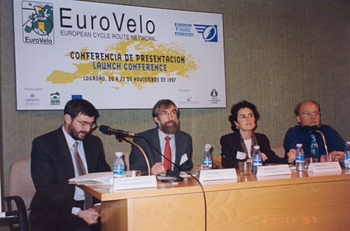
On 21 November 1997, EuroVelo, the European cycle route network, was launched in Logroño, Spain. Back then the EuroVelo initiative was a mere vision of a dream to connect Europe by bike. But fast forward to the present, 25 years later, it now consists of 17 long-distance cycle routes crisscrossing and uniting the entire European continent, with over 90 000 km of cycle routes of which 64% are ready to use. Who could have guessed that the EuroVelo dream would become so successful?
One of the original aims of developing a European cycle route network back in the 90’s consisted of fostering the potential of such a network to lay the foundations for developing cycling tourism in Europe, and generate positive impacts for economies, society and the environment.
EuroVelo is a living project. Every year the overall quality of the network improves and new sections are realised, thanks to a coordinated effort between the network of National EuroVelo Coordination Centres and Coordinators (NECC/Cs), developing and communicating the routes at the national level, and the ECF’s EuroVelo Management Team working at the transnational level. Every three years, partners can also apply for new extensions to be added to the network.
EuroVelo is acting as a backbone for cycling tourism across Europe, allowing countries to use the routes as a reference to develop adjacent national, regional and local cycle networks, fostering cycling tourism to boost local economies and transforming the tourism sector to one that is greener, healthier and more inclusive.
The GPX tracks download button
25 years after the launch of the EuroVelo network, we are thrilled to go live with a much-requested feature: the ability to download the GPX tracks of EuroVelo routes!
Given that EuroVelo is a living project, not all sections of the network are fully developed so far. This is one of the reasons why GPX tracks of the routes were not available for download on www.EuroVelo.com. Until now! A lot of coordination has been needed to find the best way to share the tracks of a 90,000 km cycle network still in development and subject to change over time.

But now, the GPX tracks download button is finally available on EuroVelo route pages and stage pages! You can download GPX tracks either for developed sections only, or for the full EuroVelo route or stage (only the developed sections can be downloaded for the routes crossing France, Portugal and/or Spain). Browse the pages now to discover this new feature.
Downloaded tracks are made of shorter sections (the suggested “daily sections”) of about 50 km. For each of them, the “route development status” is indicated in the track segment’s name: route sections can be certified, developed with EuroVelo signs, developed according to national standards, under development or at the planning stage. When downloading EuroVelo GPX tracks it is required to read the disclaimer, which includes a description of the development statuses as well.
If you are planning a shorter trip or if you wish to combine EuroVelo and other cycle routes in your exploration of a region, you can also find downloadable GPX tracks on many national cycling platforms. Browse the ‘country per route’ pages on www.EuroVelo.com to find relevant websites! When GPX tracks corresponding to the national section of a EuroVelo route are available for download, the link is included in the introductory text.
Where does the GPX data come from?
What is the source of this data? GPX tracks of the EuroVelo network are shared every year by the NECC/Cs. These tracks correspond to the official latest developments of the routes in all countries covered by the network. While ECF and National EuroVelo Coordination Centers and Coordinators (NECC/Cs) are making every effort to ensure the tracks and their levels of development are both current and accurate, errors or outdated information can occur. That is why we ask users to take the time to plan their route carefully, to take full responsibility for their own safety when making use of the tracks and to follow national traffic rules and signage.
EuroVelo GPX tracks performance has been tested on Garmin Basecamp, QGIS, RideWithGPS and Komoot. We cannot attest to the performance of the tracks in other GPX data visualisation software providers, so again stay safe when using the tracks on different services to the ones listed above. Make sure to double check the development status of the sections you plan to ride on www.EuroVelo.com! In the meantime we will be working on guaranteeing an optimal performance of the tracks on other software providers and apps.
You can keep on supporting the EuroVelo network and its development by making a donationand/or choosing to cycle your bike for your next holidays!
EuroVelo 25th Anniversary

After all these years of coordinated efforts, the vision of a European cycle route network has become a European success story!
To mark this milestone of the EuroVelo network laying the foundations for developing cycling tourism in Europe, we will be celebrating the 25 years of EuroVelo with an online event on 21 November 2022. More details about the program will follow, but for now please save the date!
Having reached this important milestone EuroVelo wants to give back to its community in way of saying thank you for supporting the growth of the network, so stay tuned for more activities to come as we celebrate these 25 years and continue fostering #MoreCyclingTourism.
Authors: Marta Orihuel and Florence Gregoire