How can you lend a hand to EuroVelo? Help us collect data!
When planning a trip, many cyclists find it useful to have access to route data. What are they going to find out there? Separated cycle infrastructure or routes shared with cars? Perfectly asphalted cycle paths or gravel roads through the forest? Detailed route data allows to choose your itinerary wisely, depending on the type of experience you’re looking for and the bicycle you’re using.
But detailed route data is not so easy to get by when we’re talking about a 90,000-km cycle network spreading across 38+ countries! We do have a methodology to collect GIS data from cycling and surveying routes – the European Certification Standard (ECS) methodology – but it would require too much time and expenses to open it to volunteers for now.

However, the world happens to already have an “open geographic database updated and maintained by a community of volunteers via open collaboration” (source) – that’s OpenStreetMap (OSM)! At EuroVelo, we are trying to bridge the gap and access the data that has been mapped for EuroVelo routes on OSM. There are a few limitations, such as discrepancies between tracks on EuroVelo.com and OSM and differences in the level of detail of available data across the continent, but OSM remains the most direct solution to obtain general, open data on EuroVelo routes. And it’s the fruit of a collaborative effort across the world!
ECF has been analysing cycle data from OSM since 2022 with the QECIO tool, quantifying the different types of cycling infrastructure across European countries and regions and providing statistics on surface types of cycle tracks and uptake of contraflow cycling. The upcoming QECIO 3.0 will include an analysis of OSM cycle data focusing on EuroVelo routes, opening a new world of possibilities!
So, how can you contribute to EuroVelo? Become an OpenStreetMap contributor in your area! Check how EuroVelo routes are included in the map, if their itinerary matches the tracks you can download on www.EuroVelo.com and the signage on the ground, and if main route infrastructure parameters are correctly mapped: route components, surfaces, potential obstacles… Then grab your bike and smartphone and start mapping any missing features!
But how does it work, and where to start? Entering the world of maps and GIS data may sound scary, but OpenStreetMap is a welcoming community, full of people who can provide help and guidance and have developed fun and intuitive OSM mapping apps. Here are a few links to get your started!
- Beginner’s Guide to OpenStreetMap
- OpenStreetMap Wiki – check the EuroVelo page and understand how to tag
- Create your account
- OpenStreetMap Community Forum – ask your questions to the community
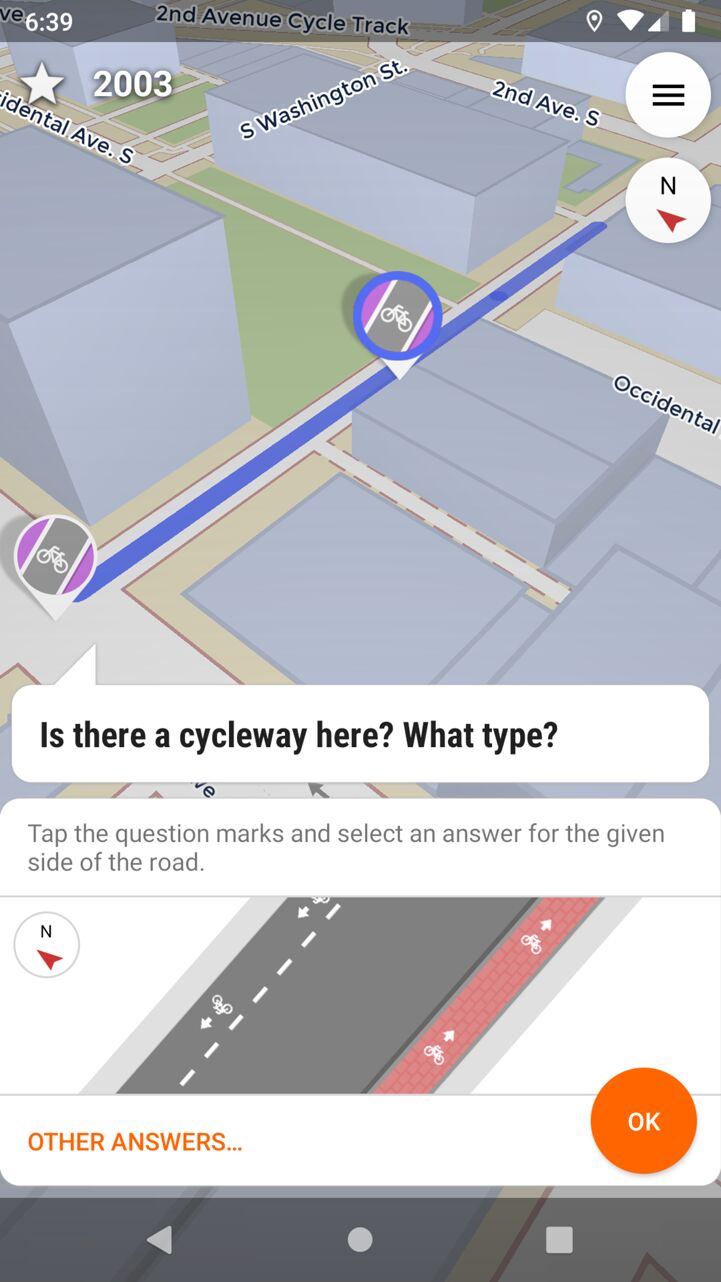
- StreetComplete – for quick editing of maps on the go

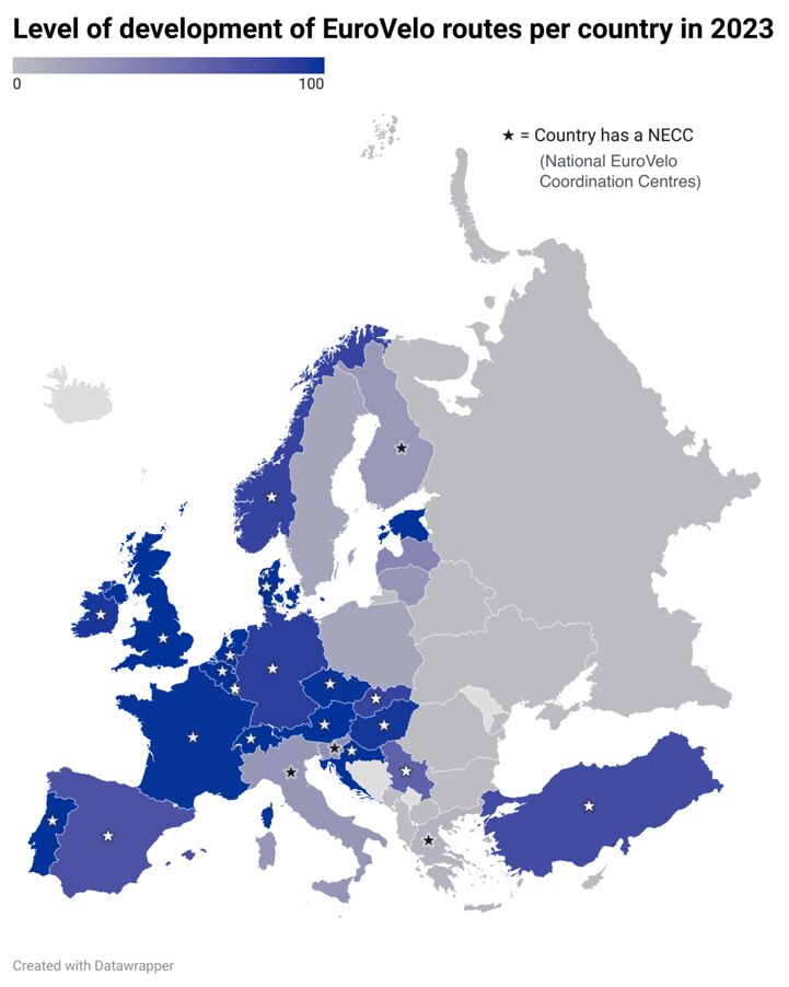
Countries currently lacking a National EuroVelo Coordination Centre are where we are most lacking data, and where EuroVelo routes tend to be less developed too. Community involvement is a real added value in those areas, so don’t hesitate to take it on!
To know more about the development levels of specific EuroVelo routes, visit the ‘stage pages’ (example for EuroVelo 15 – Rhine Cycle Route, which was certified in 2020 following precise route survey according to the ECS methodology) or the ‘country by route pages’ (example for EuroVelo 19 – Meuse Cycle Route, another well-developed EuroVelo route). The map legend explains the meaning of each colour.
As explained in the EuroVelo Route Development Status Report, not all EuroVelo routes are fully developed and signed in 2024 but we are aiming for a safe and continuous European cycle route network by 2030. The more data we can collect on the routes, the better it is for advocacy at all levels. Let us make this a collective effort across the continent!
Note that you can also bring your support to EuroVelo by making a financial donation. Support us to connect Europe by bicycle!
Author: Florence Grégoire
Cover: screenshot from waymarkedtrails.org, displaying cycle route data from OpenStreetMap